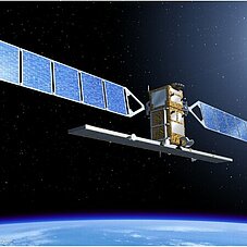
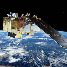
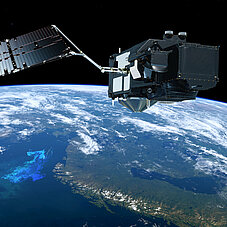
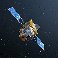
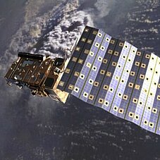
This section gives a short introduction into the Copernicus satellites, called Sentinels. Each Sentinel mission fosters special science questions and helps to understand and monitor the earth system. The Sentinel satellites evolved from further satellite missions, like ENVISAT (ESA) or the Landsat program of NASA / USGS. The Sentinel family offers data for an large scale of applications in science and economy. Detailed information of each Sentinel mission is available here.
Sentinel-1
Sentinel-1 A/B are Radar (C-Band, 5.404 GHz) satellites with a geometric resolution of 10 - 40 m and a revisit time of 6 days at the equator. A radar is an active system, so it is operational at day and night and is able to acquire images of the earth surfaces despite cloud coverage. Sentinel-1 contributes to following Copernicus Services: Land Monitoring Service, Marine Environment Service, Emergency Management Service, Climate Change Service and Security Service. For a detailed description see the ESA mission page of Sentinel-1 or for an overview of applications click here.
Due to an anormaly on Sentinel-1B with the power supply on December 2021, the mission of Sentinel-1B officially ended by ESA in August 2022. Sentinel-1A is still operational, but the revisit time with just one satellite in orbit is around 12 days. Sentinel-1C will be launched as soon as possible to fill the gap. Planned launch is in December 2023.
A publication concerning Sentinel-1 is available online: https://sentinel.esa.int/documents/247904/349449/S1_SP-1322_1.pdf
Sentinel-2
Sentinel-2 A/B are multispectral optical sensors with 10 m, 20 m and 60 m pixel resolution and a revisit time of 5 days at the equator and around 3 days in higher latitudes in a two satellite constellation. This improves the probability to acquire cloud free images during the vegetation period. The Sentinel-2A unit was launched in June 2015, the second unit Sentinel-2B was launched in March 2017. Two more identically units are on order and are expected to be launched after 2023. Sentinel-2 supports the Copernicus Land Monitoring Service, Emergency Management Service, Climate Change Service and Security Service. More information about Sentinel-2 is available on ESA's mission page and examples of applications are described here.
Detailed Sentinel-2 publication: https://sentinel.esa.int/documents/247904/349490/S2_SP-1322_2.pdf
Sentinel-3
Sentinel-3 is a medium resolution (300-1200 m) imaging and altimetry satellite. Sentinel-3 A/B monitors sea and land surface parameters. One satellite has a revisit time of 27 days, but because of the width of the SLSTR swath, it aquires data every two days. With a constellation of two satellites a daily global coverage can be achieved for SLSTR. Sentinel-3 carries 4 main instruments:
OLCI: Ocean and Land Colour Instrument
SLSTR: Sea and Land Surface Temperature Instrument
SRAL: SAR Radar Altimeter
MWR: Microwave Radiometer
The main objective of the SENTINEL-3 mission is to measure sea surface topography, sea and land surface temperature, and ocean and land surface colour with high accuracy and reliability to support ocean forecasting systems, environmental monitoring and climate monitoring. The mission definition is driven by the need for continuity in provision of ERS, ENVISAT and SPOT vegetation data, with improvements in instrument performance and coverage. Sentinel-3 supports the Copernicus Land Monitoring Service, Marine Environment Service and Climate Change Service. More information is available on the ESA Sentinel-3 mission page and actual applications can be found here.
Sentinel-3 special publication: https://sentinel.esa.int/documents/247904/351187/S3_SP-1322_3.pdf
Sentinel-4
Sentinel-4 is a payload for monitoring the atmosphere chemistry on MTG-S1 and MTG-S2 (geostationary satellite, also known as Meteosat 3) and will be launched in 2022. It has a geometric resolution of 8 km and a revisit time of 60 minutes. Europe and North Africa (Sahara) will be covered by scanning an area of 8.8° East-West x 16.6°. In particular, Sentinel-4 will record the key air quality trace gases like O3 (Ozone), NO2 (Nitrogen dioxide), SO2 (Sulfur dioxide) and aerosol and cloud properties for the Copernicus Atmosphere Service. More information is available on the ESA mission page.
A factsheet of Sentinel-4 and the special ESA publication is available following the links.
Sentinel - 5P (Precursor)
Sentinel-5 Precursor is a satellite mission launched on 13 October 2017. This is a backfill mission to ensure data continuity until the launch of Sentinel-5, the dedicated atmospheric Copernicus mission, which is scheduled for launch in 2021. A detailed description can be found on the ESA mission page. A fact sheet and an overview of applications are available by following the links.
Sentinel - 5 (on MetOp-SG)
Sentinel-5 will be a payload on the MetOp SG, scheduled for launch in 2025. The geometric resolution is between 7.5 - 50km and has a revisit time of one day. Sentinel-5 measures atmospheric gases and trace gases like O3 (Ozone), NO2 (Nitrogen dioxide), SO2 (Sulfur dioxide) and aerosol worldwide. More information is available on the ESA mission page and on the WMO page of Metop-SG-A1.
Sentinel - 6
With global mean sea level rising because of climate change, Copernicus Sentinel-6 is the next radar altimetry reference mission to extend the legacy of sea-surface height measurements, until at least 2030. The satellite carries a Poseidon-4 radar altimeter and a microwave radiometer. Every 10 days, Sentinel-6 provides sufficient measurements to map the sea-surface height of the ocean from which sea-level rise can be computed. This gives the ‘big picture’ allowing us to chart the sea level with confidence. Sentinel-6 was launched on 21 November 2020 in Vandenberg, California, USA. More information is available on the ESA website.
Measuring the sea surface
Copernicus-Expansions-Missions
After the launch of Sentinel-6 "Michael Freilich" in November 2020 the development of new satellite missions for the Sentinel family has not yet come to an end. ESA is analysing new Sentinel missions for the future. There are high-priority candidates currently studied, which could follow in the future as new Sentinels. Further information about those missions are available here.

Contributing Missions
The Copernicus program is supported by contributing missions, which adds data from different sources to the data provided by the Sentinel satellites. The contributing missions deliver complimentary data to ensure that a whole range of observational requirements is satisfied. Contributing missions are missions from ESA, their Member States, Eumetsat and other European and international third party mission operators that make some of their data available for Copernicus. More information is available here.
An overview of the Copernicus contributing missions is shown in the figure below.

ESA's Earth Observation Missions
The figure shows an overview of ESA's EO missions in the past, actual running and planned for the future.

